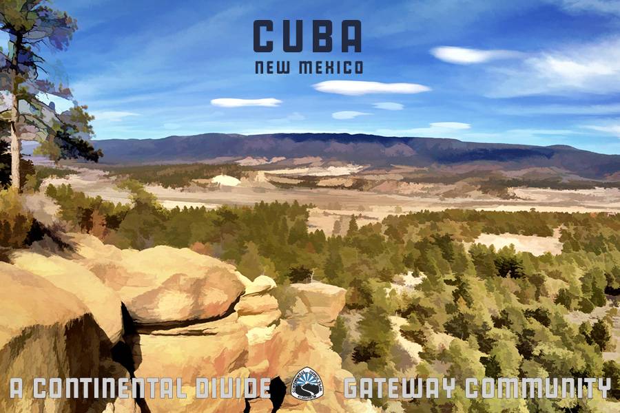
Nestled against the Sierra Nacimiento on the western border of New Mexico’s Santa Fe National Forest, Cuba sits atop the Continental Divide at 6,900 feet, and is home to 750 residents in this diverse Gateway Community. A hidden gem, Cuba is tucked between notable cultural hubs and recreational hot spots of the enchanted high desert and Four Corners region, including Chaco Canyon National Historical Park, San Pedro Parks Wilderness, and the Jemez Mountains. A well-anticipated stopover on the broad and well-maintained US Highway 550 thoroughfare, Cuba offers full-service amenities and a wealth of opportunity for adventure-seekers and Southwest enthusiasts alike.
Na’azísí Bito’ (Gophers’ Water) is the Navajo place name for Cuba. Since the 11th century, this wilderness area of the Upper Puerco was used by subsistence cultures, including the the Apache, Navajo, and Pueblo peoples. This region is located within the Navajo Four Sacred Mountains, and many landforms are representative of characters in the lore of these cultures. Native traditions are deeply woven into the fabric of Cuba and all of northern New Mexico.
The closest international airport to Cuba is Albuquerque (ABQ), which is about 1 and a half hours away via US-550 South. The Santa Fe regional airport is the next closest airport, and a little over 1 and a half hours away via US-550 South and I-25 North.
Cuba has many recreational activities to explore. Click here to learn about all there is to do around Cuba and about the Step Into Cuba Project. Learn about dining, shopping, and lodging options in Cuba, and check out the full Cuba regional map here!
Ten Things to do in Cuba
Go for a bike ride on Bluebird Mesa
Take in the views at Cabezon Peak
Learn some history at Chaco Canyon
Explore Fisher Trail – Cuba Mesa
Take a stroll along Rattlesnake Ridge
Enjoy a picnic at San Gregorio Lake
Experience the old west at Clara’s Trading Post
See some art at Mudwasp Studio and Roadside Sculpture Gallery
Enjoy the Sandoval County Fair
Challenge yourself at the Deadman Peaks Ultra Run
Mesa Portales, BLM Albuquerque
Difficulty: Moderate to Difficult
Length: 7 miles
Closest Town: Cuba
Directions: Drive 0.9 miles south to NM-197. Turn right onto NM-197. Proceed 4.3 miles to the dirt road on the left. Park or continue down the dirt road past sandstone bluffs to the large Chijuilla Wash.
Maps:
USGS 7.5 quadrangles: Mesa Portales and Headcut Reservoir; CDT Map Set: Map 097 and 098, Section NM24.
For More Information:
BLM, Rio Puerco Field Office: (505)-761-8700; Cuba Gateway Community webpage.
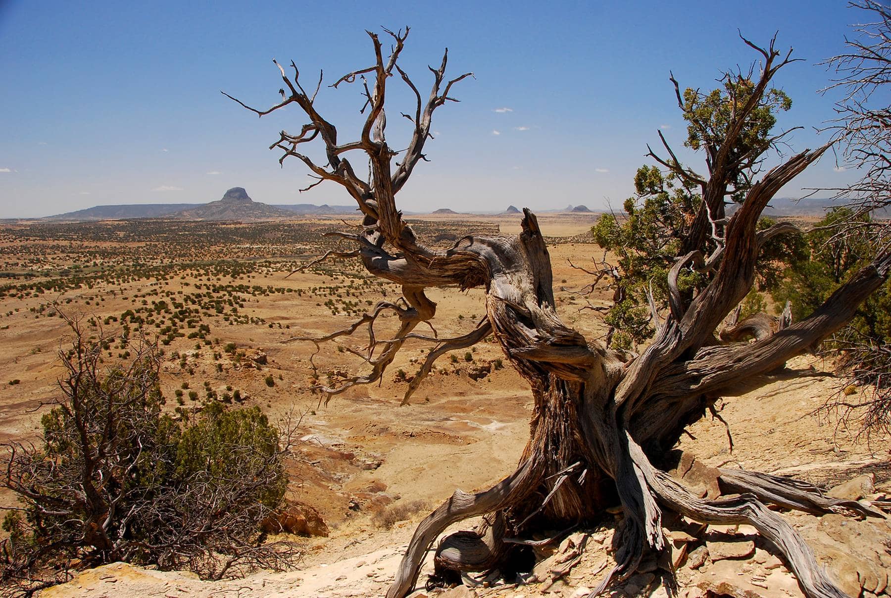
Mesa Portales NM, by Ryan Choi
I'm a thru-hiker! What do I need to know about Cuba?
- wifi
- camping/ lodging
- showers
- food
- laundry
- camp supplies
- Cuba Post Office
- 6358 US-550, Cuba
- NM 87013
- (575) 289-0483
- The Cuban Lodge
- P.O. Box 1538, Cuba
- NM 87013
- Family Dollar
- 6371 US-550
- NM 87013
- (575) 289-0046
- Richard’s True Value
- 6429 US-550
- NM 87013
- (575) 289-3705
- Saveway Variety
- 6392 US-550
- NM 87013
- (575) 289-3561
- Cuba Community Library
- 13 E Cordova Ave
- NM 87013
- (575) 289-3100
- Frontier Laundry
- 6476 US-550
- NM 87013
- Cuba Laundromat
- 6353 US-550
- NM 87013
- (575) 289-9131
- The Del Prado Motel (has a hiker box)
- 6380 US-550
- NM 87013
Submit a place
Is the thru-hiker section above missing a business or an amenity? If so, please let us know below!
CDT South
The CDT heads south from NM Highway 197 after a four mile drive from the Cuba. The trail follows a seldom driven dirt road for approximately 1 1⁄2 miles until – after passing sandstone cliffs – it crosses the wide Chiquilla Wash. It then becomes a narrow footpath marked by white posts and cairns (large rock piles) and travels through a wide arroyo to the top of Mesa Portales.
It is 6.2 miles round-trip from the parking area to a scenic viewpoint in a narrow sandstone saddle of Mesa Portales. There are scenic vistas along the entire route including badlands, sandstone cliffs, and mountain and mesa views from the Mesa Portales rim. Mountain bikes and dogs are allowed on this section of trail. Use caution crossing Chiquilla Wash – areas of quick sand exist when wet and the wash is prone to flash floods.
CDT North
The CDT heads north out of Cuba via the Los Pinos Trail. This trail follows the Los Pinos Creek for 3.1 miles while ascending nearly 2,000 vertical feet from the Nacimiento Mountain foothills to the top of the San Pedro Parks Wilderness. Once on top, a network of wilderness trails invites further exploration. Vegetation along the trail is lush and amazingly diverse. Wildflowers bloom in profusion from May to September. Views are limited until one reaches the top of the mountain.
This trail is suitable for short or long excursions and is an excellent entry point for longer trips into the San Pedro Parks Wilderness. The trail is rated as difficult due to the elevation gain and loss. Round trip to the end of the trail and back is 6.2 miles and may take from 3 to 6 hours. Camping is allowed by permit at the trailhead and in the San Pedro Parks, but be sure to practice Leave No Trace and make sure any campfire is completely out before leaving the area.


