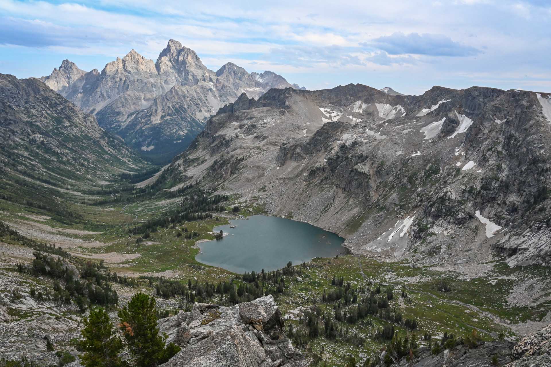
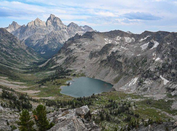
Picture yourself on one of the CDT’s longest roadless sections, right in the middle of the half-million acre Weminuche Wilderness in Colorado, where the trail tracks through high glacial valleys and offers views of the craggy Needle Mountains… or in central New Mexico, where the desert meets the mountains. The span of one day’s hike offers an immense diversity of landscapes. Extending 3,100 miles from Canada to Mexico, the CDT encounters ecosystems ranging from tundra to desert, a rich variety of wildlife, and nearly two thousand natural, cultural, and historical treasures. Considered one of the great long-distance trails in the world, it is the highest, most challenging, and most remote of our National Scenic Trails.
The trail passes through the lands of the Chiricahua Apache, Western Apache, Zuni, Pueblos, Ute, Cheyenne, Eastern Shoshone, Shoshone-Bannock, Apsaalooké (Crow), Lemhi Shoshone, Salish Kootenai, Niisítapi (Blackfoot), Ktunaxa, Tsuu T’ina, Očhéthi Šakówiŋ, and Michif Piyii (Métis) peoples, who have stewarded these lands since time immemorial, and who continue in communion with these lands today. CDTC is committed to honoring the past, present, and future of the Native peoples who hold sacred the Divide, and to continuing to work to build connections to these communities.
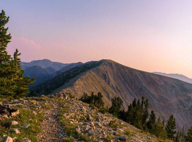
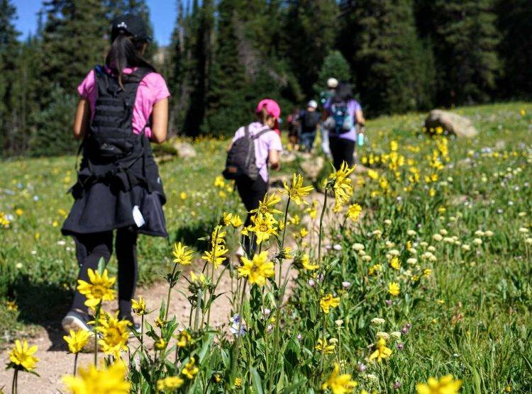
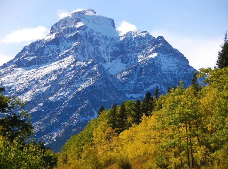
Ranging from 4,000 to 14,000 feet, the the CDT provides a variety of recreational activities to hundreds of thousands of people each year, including hiking, horseback riding, cross-country skiing, snowshoeing, wildlife viewing, fishing, hunting, and sight-seeing, mountain bicycling, backpacking, and more. For the long-distance hiking community, the CDT is one-third of the “Triple Crown,” (along with the Appalachian and Pacific Crest Trails) and annually approximately 150 to 400 ambitious travelers will attempt to complete an end-to-end trek, called a “thruhike.”
Parts of the CDT are still incomplete on public lands, and trail users must bushwhack through, or road walk around, gap areas. A completed CDT will make the rugged and scenic landscapes in the backcountry accessible to more people and will reduce the impact of trail users by concentrating them on a well-marked and resilient pathway. The Continental Divide Trail and its corridor preserve the unique history of the Divide for future generations and provides the opportunity for more Americans to access and enjoy remote landscapes. The CDT offers a primitive backcountry experience where trail users can follow in the footsteps of Native peoples, cross the expeditionary path of Lewis and Clark, explore old mining sites, and gain more of an appreciation for our lands and waters.
1925
Founding of the Appalachian Trail Conference (ATC)
Many individuals were important in laying the foundation for a national system of trails, but perhaps none more so than Benton MacKaye, forebear of the Appalachian Trail (AT). His original vision was for a footpath connecting the high peaks of the Appalachian Mountains, providing an outdoors escape for the urban dwellers of the east coast and utilizing volunteers for much of the necessary construction and maintenance. The founding of the Appalachian Trail Conference (ATC) in 1925, now the Appalachian Trail Conservancy, was a monumental step in completing the AT. The success in creating the Appalachian Trail in the 1920s inspired ideas for other long-distance trails and would lead to a western counterpart: the Pacific Crest Trail (PCT). Planning and scouting for the PCT began in the 1930s with a goal of a backcountry trail extending from Mexico to Canada through California, Oregon, and Washington. The momentum for a national system of trails was building.
1962
According to David Maceyka, he and others from the Rocky Mountain Trails Association were the first to walk and mark the proposed CDT in Colorado. Their group called the soon-to-be CDT the “Blue Can” trail, because they marked the trail by nailing blue cans t o trees so the Forest Service could locate and approve of its location. The Colorado Mountain Club also joined these efforts and, as noted in the Trails for America report, “established the 1962 recreation-first segment of the trail, extending between Empire and Rocky Mountain National Park in Colorado.”
1965
In his “Beautification Speech” in the spring of 1965, President Lyndon Johnson proclaimed: “The forgotten outdoorsmen of today are those who like to walk, hike, ride horseback, or bicycle. For them we must have trails as well as highways […] I am requesting […] a cooperative program to encourage a national system of trails, building up the […] trails in our national forests and Parks. In the backcountry. we need to copy the great Appalachian Trail in all parts of our country.”
1968
National Trails System Act Passed
The passage of the National Trails System Act in 1968 officially designated the Appalachian and Pacific Crest Trails, and directed that fourteen other possible routes be studied, including the Continental Divide Trail. The Act mandated in 1978 that future National Scenic and Historic Trails could only be authorized by Congress. Benton MacKaye would later write of the passage, “The creation of the ATC was one of two pivotal events in the history of the trail; the other was the signing of the National Trails System Act in 1968. The first provided a parent organization for clubs whose members work at maintaining the trail; the second provided federal protection for it. Achieving this protected status is the result of the enthusiasm and concern of a host of hikers during half a century. Perhaps it is unrivaled by any other single feat in the development of American outdoor recreation.”
1978
CDT Founded
The Department of the Interior conducted a study of the viability of a “Proposed Continental Divide National Scenic Trail” released in March of 1977. The study found that “Trail users would wind their way through some of the most spectacular scenery in the United States and have an opportunity to enjoy a greater diversity of physical and natural qualities than found on any other extended trail.” The proposed CDT also “would provide the recreationist with examples of past periods of American development, examples of the many ways in which we now use our lands, as well as ways in which we could make better use of our resources through public awareness and appreciation of environmental relationships and good resource management practices.”
The National Parks and Recreational Land Act of 1978 amended the National Trails System Act by adding five trails to the System, including the Continental Divide National Scenic Trail. The U.S. Forest Service was made the lead land management agency of the Trail, in cooperation with the Bureau of Land Management and National Park Service, but the Act did not provide for any direct funding for planning or construction. Serving on the early iterations of the CDT advisory council, Jim Wolf encountered many members who were initially “quite cool to the whole concept of the CDT.”
1981
Management Plan Proposed
The authorizing legislation of the CDT called for a management plan to be created and in 1981, the CDT Comprehensive Plan was drafted “to provide a uniform Trail Management Program, which reflected the purposes of the National Scenic Trail System, and at the same time, allowed for the use and protection of the natural and cultural resources found along the designated route on lands of all jurisdictions.” Among other subjects, the Plan identified a fifty-mile wide corridor on either side of the physical Continental Divide in which to locate the final route. The Chief of the Forest Service approved the Plan in 1985. The Comprehensive Plan was later amended in 2009.

1995
CDTA Formed
The lack of progress due to shrinking budgets, little public involvement, and increased demands on America’s public lands prompted the Forest Service to look for a more creative way to complete the CDT. It was the formation of Continental Divide Trail Alliance (CDTA) in 1995 that finally created public and private enthusiasm for the CDT. In 1998, CDTA set a goal to complete the Continental Divide Trail and initiated and coordinated the development of the CDT Strategic Completion Plan. The Plan outlined all of the needs, methods, and costs to complete the CDT. For the first time, federal land management agencies had identified the full scope of work necessary to complete the Trail across their jurisdictions. As a result of this process, land managers at the local level began to recognize the national significance of this immense project. In 1999, CDTA became the leading non-governmental partner in the completion of the CDT at a Memorandum of Understanding signing in Washington, D.C. For 15 years CDTA worked steadily to increase awareness, partnerships and the effectiveness of the public- private partnership working on behalf of the CDT. In 2011, CDTA had organized more than 12,000 volunteers to help complete the Trail amounting to over $7 million in Volunteer labor. But hard times hit the CDTA and in January of 2012, due to shrinking private funding, CDTA ceased operations leaving the Trail once again in jeopardy of no coordination, representation, loss of interest and public funding, and potentially leaving the Trail Corridor subject to impacts from increased developments on western lands.
2012
CDTC Formed
The closing of the CDTA left a gap in both the national coordination of Trail management, protection and volunteer stewardship, and the on the ground efforts of trail construction previously accomplished through CDTA’s annual efforts. In response to this gap, regional groups who had previously partnered with the CDTA, stepped into the construction role and with support from former CDTA staff who consulted both as volunteers and who were hired by these partner organizations, helped fill in the gaps of volunteer construction of the Trail. These partners included numerous Backcountry Horsemen of America chapters, the Bob Marshall Wilderness Foundation, Montana Wilderness Association and its CDT specific program (CDT Montana), the Colorado Trail Foundation, New Mexico Volunteers for the Outdoors, and many others. These groups have helped recruit volunteers, build awareness, and engage local communities. But this still left the gap in overall coordination and focus that only a national level leadership with the sole focus of the CDT could provide. After consultation with partner organizations, including the Continental Divide Trail Society and its founder, Jim Wolf, former CDTA Staff members, volunteers, supporters and members of the CDT thruhiking community formed the Continental Divide Trail Coalition. Officially incorporated in June 2012, CDTC hit the trail running and continued the important work initiated by the CDTA, but with organizational differences to promote greater success:, CDTC is leveraging the strengths of its broad community of trail partners, local communities, enthusiasts, and supporters to build a strong coalition of support for the CDT, so it remains a trail of national and international significance. Ten years after the inception of CDTC, the trail is now 96% complete on public lands, and the coalition has signed a M.O.U. with the U.S. Forest Service in recognition of CDTC as the lead non-profit partner for stewardship of the CDT.


