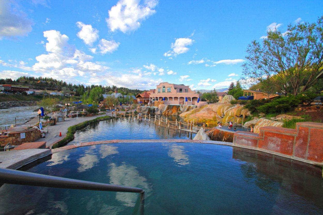
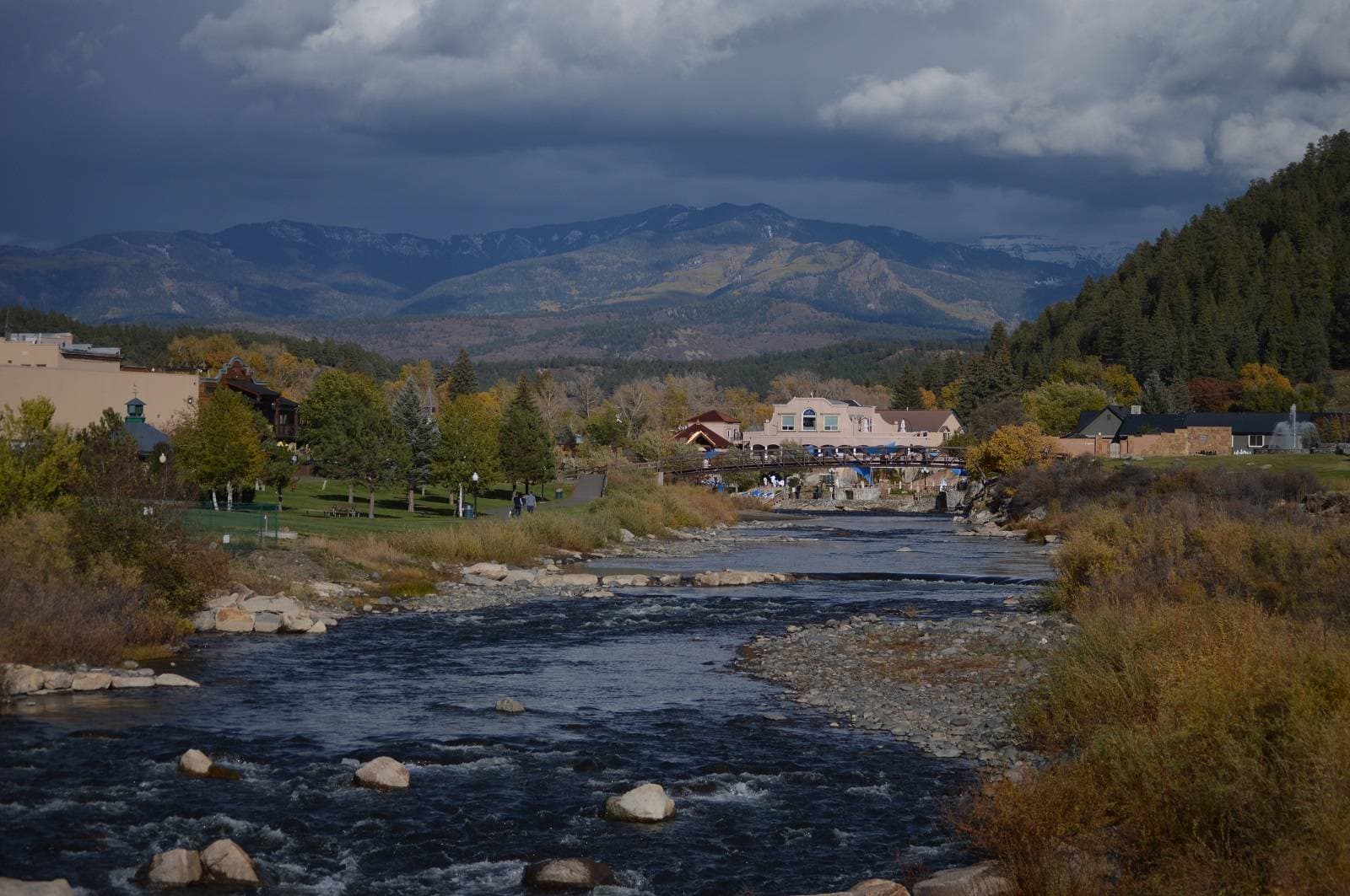
Pagosa Springs sits high in the San Juan Basin, where the high desert plateau to the west meets the Rocky Mountains, and adjacent to the 3-million-acre San Juan National Forest to the north and east. Native Americans, including the Diné Bikéyah (Navajo), Pueblos, and Núu-agha-tʉvʉ-pʉ̱ (Ute) peoples, who inhabited this area long before white settlers arrived were drawn to the warm, bubbling waters of the geothermal hot springs along the San Juan River. The name Pagosa comes from the Ute word meaning “smelly water” or “healing water.”
When gold was discovered in the surrounding San Juan mountains in 1860, prospectors and settlers flooded in. By 1878, Fort Lewis was established at the springs in order to protect settlers from tribes in the area. The construction of the Denver & Rio Grande Railroad in 1881, which passed 30 miles to the south, spurred settlements further afield. The town of Pagosa Springs, buffeted by the nearby railroad construction, grew around Fort Lewis and was incorporated in 1891, after Fort Lewis was moved west. Word spread far and wide amongst settlers about the hot springs, and visitors began to arrive around this time, but logging and ranching were the primary industries here. Both received a major boost when the Railroad constructed an extension reaching all the way to Pagosa Springs in 1990. By the 1920s, however, most of the easily accessible timber had been logged, and the subsequent Great Depression drove many out of the area to larger towns in search of work. It became a relatively sleepy town until the 1970s, when land developers began touting the scenery and hot springs to newcomers. Today, it primarily caters to tourists, popular both with outdoor recreationists and springs-seekers.
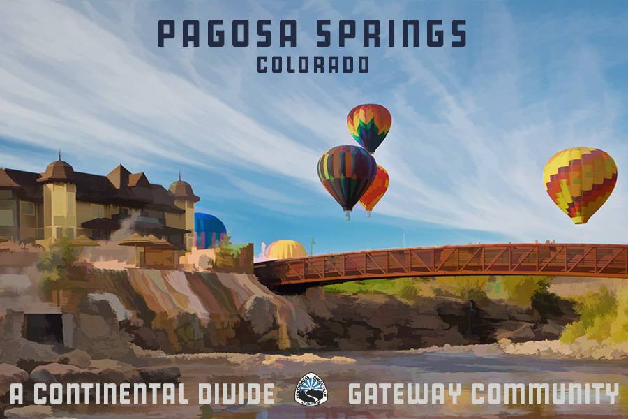
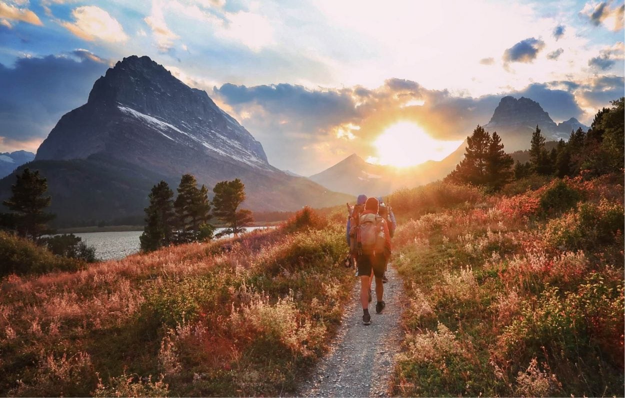
Pagosa Springs combines a relaxed, small-town atmosphere with abundant outdoor recreation, plenty of services, excellent soaking. and fantastic scenery for a unique experience on any CDT adventure.
Information courtesy of Archuleta County and the Pagosa Springs Visitor Center.
The closest international airport to Pagosa Springs is Albuquerque International Sunport (ABQ), which is about 3.5 hours away via US-84 W. The Durango-La Plata County Airport (DRO) is the closest regional airport to town, and is about 1 hour away via US-160 E. The airport is serviced by American and United Airlines and offers daily non-stop flights to and from Denver, Colorado; Pheonix, Arizona; and Dallas-Fort Worth, Texas. Rental cars are available at the airport.
The Mountain Express
The town’s public transportation-operates during the day Monday through Friday
Wilderness Journeys
Local shuttle service-offers shuttle service to the CDT and other trailheads in the area, as well as to and from the Durango-La Plata County Airport
Ten Things to do in Pagosa Springs
Go on a hot air balloon adventure
Catch a show at the Pagosa Center for the Arts
Spend the afternoon ice skating
Learn some history at the Pagosa Springs History Museum
Experience the history of the Ute people
Create some art
Take a trip down the river
Learn to play disc golf
Take a soak in the hot springs
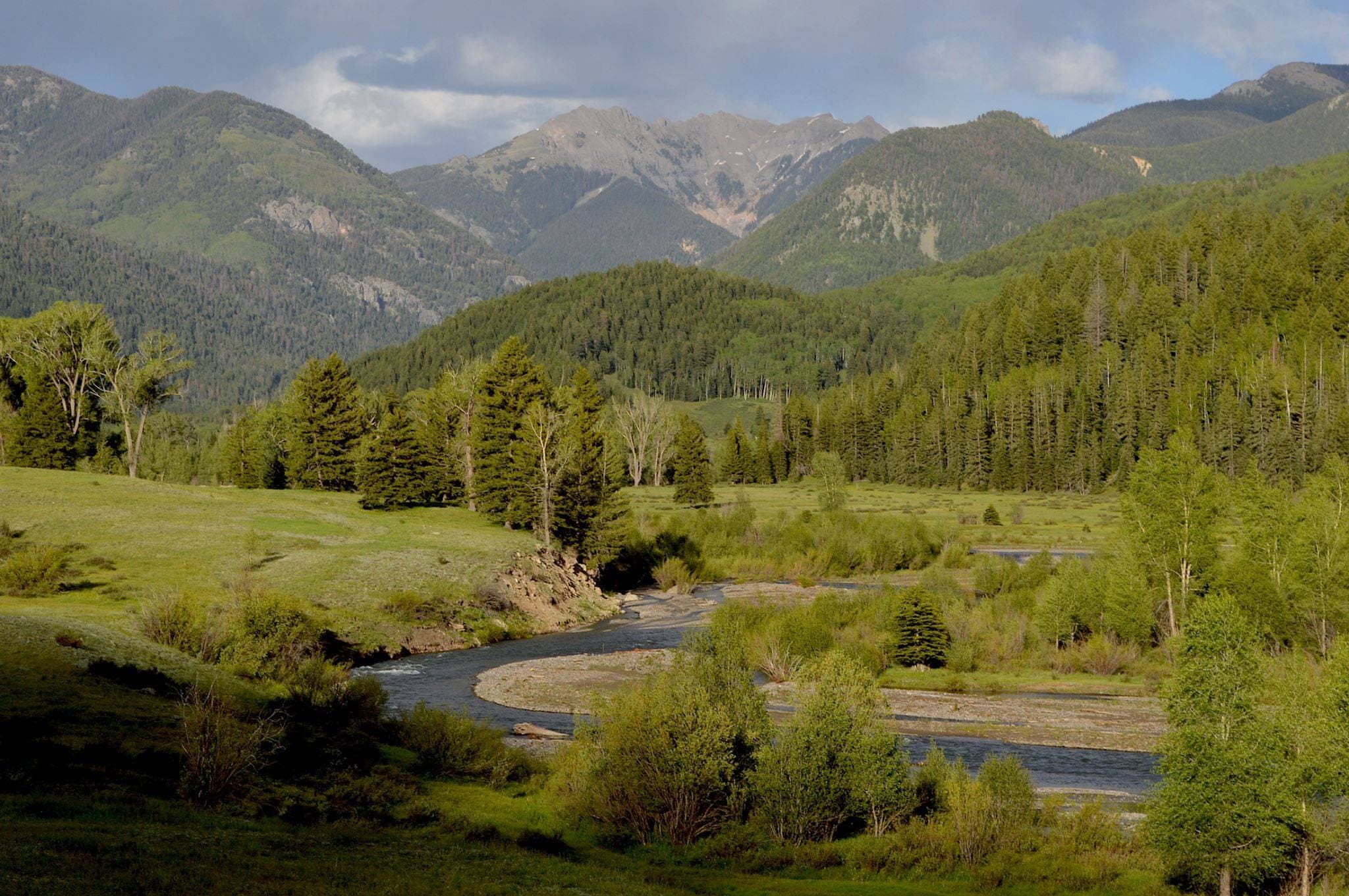
Wolf Creek Pass to Rock Lake, Rio Grande National Forest
Difficulty: Easy
Length: 8.8 miles
Closest Town: Pagosa Springs and South Fork
Directions: Take US-160 north from Pagosa Springs for 23 miles to Wolf Creek Pass, or take US-160 south from South Fork for 20 miles. Note that US-160 is steep (6.8 percent grade) and often icy or snowy. There is a large covered kiosk at Wolf Creek Pass describing the history of the Divide and the CDT. Just east of the pass, on the north side of the road, there is a gravel road, accessible to two-wheel-drive cars, that will take you to the Lobo Overlook. There is ample parking near the microwave tower. From the Lobo Overlook, walk west of the microwave tower to find the trailhead for the spur trail to the CDT heading north. The trail is well worn and easy to follow. Generally head west and slightly downhill until the trail meets the CDT, which is marked by a post, 0.25 miles later. Turn right onto the CDT and head north to continue on your hike!
Maps:
USGS 7.5 Quadrangle: Wolf Creek Pass; Trails Illustrated #140; CDTC Map Set: Maps 126 and 127, Section CO04.
For More Information:
Rio Grande National Forest, Divide Ranger District: (719)-658-2556.
I'm a thru-hiker! What do I need to know about Pagosa Springs?
- wifi
- camping/ lodging
- showers
- food
- laundry
- camp supplies
- Re-Sport
- 100 Country Center Dr, Pagosa Springs
- CO 81147
- 970-731-6900
- Footprints
- 458 Pagosa St, Pagosa Springs
- CO 81147
- 970-264-3668
- Pagosa Mountain Sports
- 62 Pagosa St, Pagosa Springs
- CO 81147
- 970-507-7886
- Summit Ski & Sports
- 172 E Pagosa St, Pagosa Springs
- CO 81147
- 970-264-2456
- The Outfitter
- 21 Pike Dr, Pagosa Springs
- CO 81147
- 970-264-1321
- Goodman’s
- 402 Pagosa St, Pagosa Springs
- CO 81147
- 970-264-5460
- Ski & Bow Rack
- 354 E Pagosa St, Pagosa Springs
- CO 81147
- 970-264-2370
- Pagosa Springs Post Office
- 250 Hot Springs Blvd, Pagosa Springs
- CO 81147
- 970-264-5440
- Pinewood Inn (accepts packages)
- 157 Pagosa St, Pagosa Springs
- CO 81147
- 970-264-5715
- Pagosa Springs Visitor Center
- 105 Hot Springs Blvd, Pagosa Springs
- CO 81147
- 970-585-1200
- Ruby M Sisson Public Library
- 811 San Juan St, Pagosa Springs
- CO 81147
- 970-264-2209
- Healing Waters
- 317 Hot Springs Blvd, Pagosa Springs
- CO 81147
- 970-264-5910
- Ross Aragon Community Center
- 451 Hot Springs Blvd, Pagosa Springs
- CO 81147
- 970-264-4152
- Laundry on the Hill
- 2339 Eagle Dr, Pagosa Springs
- CO 81147
- 970-731-4100
- Navajo Trails Laundry
- 75 Navajo Trail Dr #1, Pagosa Springs
- CO 81147
- 970-731-2223
- Riff Raff Brewing
- 274 Pagosa St, Pagosa Springs
- CO, 81147
- (970) 264-4677
Submit a place
Is the thru-hiker section above missing a business or an amenity? If so, please let us know below!
From Wolf Creek Pass
Take Highway 160 east from Pagosa Springs to Wolf Creek Pass. Just past the Continental Divide kiosk at the pass, take the dirt road on your left. In 1.5 miles, you’ll reach the Lobo Overlook parking area at a microwave tower site. The trail takes off behind the microwave tower. Hike as far as you’d like through the San Juan Mountains & the Weminuche Wilderness, but Rock Lake makes a good day hike destination.
From Williams Creek Trailhead
It’s 14 miles from the trailhead to the CDT, so plan accordingly. Whether or not you’re aiming to reach the CDT, you’ll enjoy the rugged volcanic peaks that surround the trail in its first few miles. From downtown Pagosa Springs, head west on San Juan St/Hwy 160. Turn right on Piedra Rd, about two miles from downtown. Follow the road for about 22 miles, then turn right on Williams Creek Rd (FR 640) and continue past Williams Creek Reservoir to the road’s end in about 5 miles. Most of the Williams Creek Trail is in the Weminuch


