Current Closures and Alerts
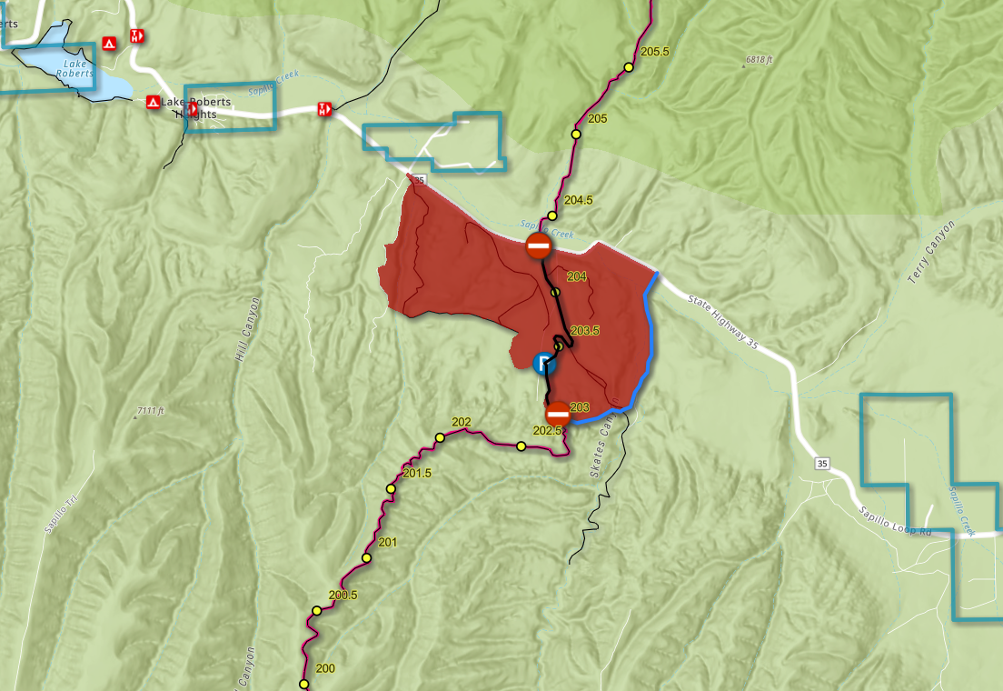
The Gila National Forest, Wilderness Ranger District is implementing an area closure while it conducts the 320-acre Sapillo prescribed fire project. The area closure goes into effect at midnight on April 8 and will remain in effect until the area is safe for public re-entry. This area includes a 1.2 mile section of the CDT.
CDT users should use Forest Roads 4078R and 88 as bypass routes. They bypass the burn unit to the east. At the intersection with Forest Road 4078R, hikers should follow the road to the east toward Skates Canyon, then following Forest Road 88 north out to NM Highway 35, and along 35 back to the west to get back to the trail. Signs will be posted with those directions.
Fore more information click here.
Day use is prohibited along the CDT (mile 1372-1396), and the Tonahutu Creek cutoff, in Rocky Mountain National Park due to the East Troublesome Fire of 2020. The National Park Service is limiting use to only those that obtain a wilderness permit. Permits can be obtained online here. CDT users should select the “North Inlet” starting point when searching online for permits. Please note – hard-sided bear canisters are required with a wilderness permit. Canisters can be rented in Grand Lake, CO at Never Summer Mountain Products.
For more information on wilderness permits click here or call the Kawuneeche Visitor Center at (970) 627-3471. For more information about fire regulations, please visit this site.
Updated 10/23/23 – 4:43 pm MST
Please note that road names given in suggested reroutes may not match road names in Google Maps and other mapping applications based on OpenStreetMap.
Fire Restrictions
Fire restrictions for lands the CDT passes through are listed roughly south-to-north by state. If you aren’t sure which national forest, park, or BLM unit you’ll be visiting on your CDT adventure, find out using the map above by clicking the section of trail you plan to visit. Please note that the definitions of “Stage 1” and “Stage 2” fire restrictions vary slightly by agency.


